 |
|
|
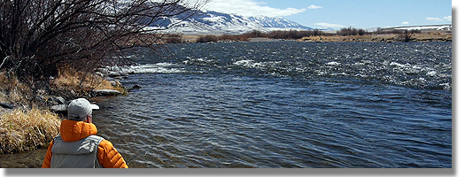
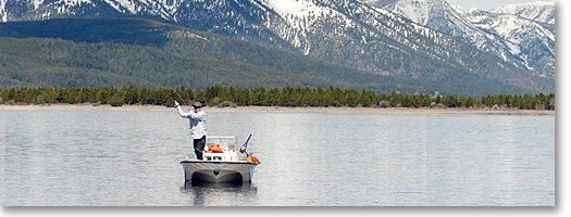
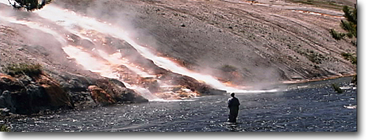
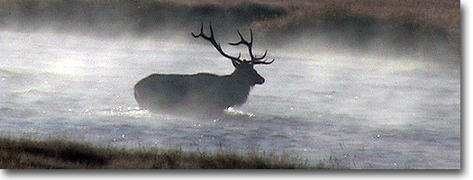
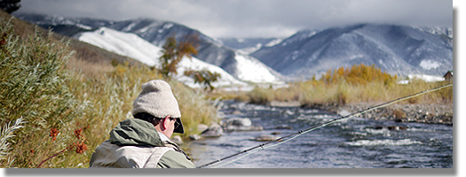
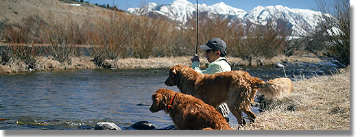
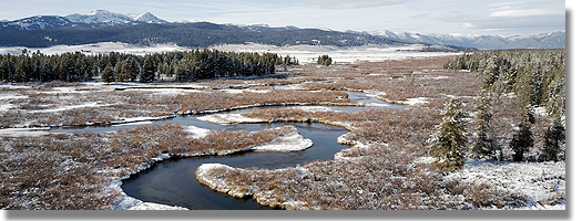
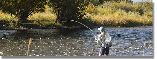
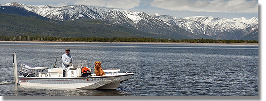
| Madison River It was in National Park Meadows where the Gibbon and Firehole come together to form the Madison that the Langford-Washburn-Doane (August-September 1870) expedition conceived the idea of making the area a national park. It was the world's first and it came to be in less than two years (March 1, 1872) after it was proposed to Congress. For this, and to the farsighted men of this expedition, we should be eternally grateful. As mentioned earlier, these large meadows extend upstream nearly a mile along the Gibbon and a shorter distance up into the mouth of Firehole Canyon. Roads come in from Old Faithful along the Firehole from the south, from Norris Junction along the Gibbon from the northeast, and from West Yellowstone to the west to form Madison Junction. All three of these roads run parallel and close to these streams, making them among the most accessible trout streams in the world. The meadows lie in a flat bench in a broad canyon, and the water is typically large meadow stream with large deep pools and runs. There are tremendous beds of aquatic weeds, deeply undercut banks and numerous potholes to provide cover and holding places for trout. Formerly, this stretch held many three- to five-pound trout, but though some are still there, they are fewer due to warming of the water. This warmth is due to the warming of the Firehole, which provides over 70 percent of the volume of the Madison at this point. The Firehole also supplies mineral richness, sillcates for the building of diatoms-algae, the cell walls of which are formed of silica- and calcium bicarbonate which is used by plants, insects and trout in quantity. The Madison in the Park has over one hundred parts per million of calcium bicarbonates, thus is as rich in this mineral as most chalk streams. Because of the weeds (Potamogeton, Cerratophylum and Myriophylum) this stretch is mostly dry fly fishing, or the emergent nymph can be used. At the very elbow of Big Bend, mentioned below, is a great deep pool which must be fished with nymphs along the bottom. The fish here simply will not come up to the fly. In hopper season, those patterns fished along the banks and between the weed beds are the best bets because of the juicy splat! they make when they hit the water. The fish can hear or feel this and it brings them out of hiding among the weeds or from under the banks to assault this bonus with a spray-shattering rise. The river swings away from the Madison Junction-West Yellowstone road about a half-mile from its headwater, over to near the south edge of the Madison Plateau and Three Brothers Peaks. National Park Mountain is the north-facing eastern rampart of the plateau, looming over the spot where the Langford-Washburn-Doane party sat around a campfire and dreamed of a national park. The river swings back to the road about two miles from Madison Junction at the western (downstream) end of what is known to fishermen as Big Bend. The river is squeezed between high banks and the current accelerates around a couple of right-left, curves and shoots down a three-quarter-mile-long riflfle that holds few trout worth the anglers time. There is a deep spring hole across the river where it rejoins the road and a nine-pound brown was taken here once upon a time, and there is still a lunker or two in this spot. Beyond the riffle is a short bench meadow section where the river divides around islands. Weeds, deep undercut banks and potholes in the bottom provide excellent holding for large trout. A short, deep run is followed by another small meadow stretch, then a half-mile-long riffle, mostly unfishworthy, leads into a curving run that ends at upper Nine Mile Hole. This curving run holds only panfish most of the summer and fall. But when the browns are running-now usually October because of the warming of the water-one can get into many trout and large trout in this run. From lower Nine Mile Hole to Seven Mile Bridge is a huge marsh that is very dangerous. One can simply go over his waders in silt-filled potholes, along the bank as well as in the stream. Seven Mile Run commences a few feet above Seven Mile Bridge, the only bridge over the Madison in the Park. It and Nine Mile Hole are so named because they are these, distances from the Park's west entrance. The Run reaches for a half-mile down around a big curve, flanked by a steep lodges pole slope on the right, with the road and a picnic area on the left. It has many weedbeds with channels between, tree drifts and other debris, huge boulders and ledges. It is choice and challenging. I believe the trout to be more elusive and difficult here than anywhere else on the entire river. Running from the curve ending the Run, for over a half-mile stretches famous Grasshopper Bank, named by Dave Whitlock (who loves it dearly as do many other noted anglers, including venerable Art Flick). It is a long, fairly deep, many-channeled run, the channels being grooves between hillocks and ridges of weed beds. It is most tricky to wade. One may stand knee deep on one of the weed-bed ridges, take a single step and be up to his armpits. Light conditions here are murderous. Though the current is quite moderate, use a wading staff to probe ahead before taking that next step. Grasshoppers abound in July through September on the sloping grass- and sagebrush-covered right bank that gave the run its name. Also in this spot, in August and September, one will encounter hatches of Dicosmoecus atripes caddis, the Great Orange Sedge. This or an orange-bodied hopper will produce well until the first heavy fall snow. There is a damlike breakover at the end of this stretch, just where the new road swings away from the river, although the old road down along the three-mile stretch, known as Long Riffle, still is open to traffic. This riffle is almost purely a spawning and nursery stretch. Coming in from West Yellowstone, six-tenths of a mile into the Park, a road turns left, running narrowly and inconsequentially through the lodgepoles, around a curve, dropping down a little hill, across the flat to the river. Here begins three miles of truly excellent wet fly and nymph water. The first stretch, at the parking area across from a rocky bluff, is locally called Hole Number One, and the entire stretch is called "the Barns Holes," due to the fact that stagecoaches, horses and, later, busses, were kept here for trundling people into the Park. All are gone now, but the name remains. To the left, downstream three-eighths of a mile, is Hole Number Two, a parking area and end of the road. Still another three-eighths of a mile by foot is Hole Number Three, the last of the locally named or numbered holes, which in fact are deep, fast runs. There are actually seven or eight of these from Cable Car Run just above Hole Number One, to the Beaver Meadows about three miles downstream. But only the first three are named by locals because, in the 1920s when the limit was twenty-five fish, it wasn't necessary to go beyond Hole Number Three to fill your limit. The predominant insect throughout this stretch, and for most of the Madison all the way to Ennis, is Pteronarcys californica, the giant stone or "salmon" fly. There are also many Calineuria californica, the yellow stone fly. The big Pteronarcys nymphs are about two inches long at maturity, the Calineuria about two-thirds as large. These nymphs are in the water four and three years respectively from egg to emerging adult. They outweigh all other insects in the stream and form the greatest portion of the trout's food supply. Thus, an artificial representing them is the best day-in, day-out fly to use. This heavy fast water is best fished with a sinking line (Hi-D), a leader of two feet and not less than OX and a size 4, 4XL weighted black nymph or Black Woolly Worm. Some streamers. Spruce, Green or Brown Marabou Muddlers or sculpin imitations are used with success. The fast choppy water ends at the Beaver Meadows, a marshy, boggy, beaver-tunneled, willow-clumped area about five river miles long that ends at Baker's Hole at the Park boundary. This is mostly flat water, pools, glides, flats, with an occasional short, fast stretch. It is predominately dry fly water, although the big dragonfly nymphs will work at times. From the broad depths of Baker's Hole, where there is a state campground, on into Hebgen Lake, is the stomping ground of the "gulper" fishermen, those sly and secretive fellows and gals who gather here at dawn or sometimes dusk to fish very tiny dry flies for nice large trout. They use float tubes, canoes, kayaks, punts, cartop boats and, occasionally, cabin cruisers to pursue their elusive quarry. The water coming from the tailrace of Hebgen Dam is always around 40 degrees, and for the next two miles, to the head of Quake Lake, this water is warmed just enough to make the trout happy. Because of stable flow and temperature, this is the most predictable stretch of the river. I usually open the season here, and even then (late May) one can get dry fly fishing with the Elk Hair Caddis. The water comes raging over the slide dam of Quake Lake, roars down a long, narrow chute and pours foaming into the Slide Inn Run. This is choice water, with many trout and large trout. It is loaded with insects-the big stone flies, several mayfly species, many caddis, crane fly larvae and sculpins. This was so even before the 1959 earthquake that created Quake Lake. From the U.S. Highway 87 bridge over the river, down to Varney Bridge (about thirty-five miles of river), the water is much the same-long riffles with a few somewhat deeper runs. It is boulder- and rubble-bottomed fast water fishing that offers good fishing, excellent really, since it was changed to a no-kill area five years ago. But it does not offer great variety of choice of water type or tactics. Though there are favorite spots all along this stretch, they are similar enough to require the same flies and methods-caddis dries, the big rough water dries, stone fly nymphs and some streamers. It usually takes trial and error to arrive at the taking method. Some favored spots are the end-of-road area on the left bank three or so miles above the West Fork, spot sections of deeper water all the way down and the piece above and below the West Fork Bridge. The five-mile section from Wolf to Squaw Creek is a special study section closed to fishing. The results of this continuing study are used to maintain or improve the fishery in the rest of the river and in other streams in Montana. There are campgrounds at Palisades and Ruby Creek, and a boat launching place at McAtee Bridge on this stretch. From McAtee on to Varney the river begins to assume a different character, with deeper water that is boulder filled and good throughout. Here, to insure success, one must be thorough and cover the water, because there are many large trout in this stretch and there is no way for the angler to tell just where they are lying. Below Vamey Bridge this deepening of the water continues, making it harder to judge where the fish are, but the dividing of the river around islands (the Channels) gives the fisherman a somewhat more manageable piece of water to work. I would earnestly advise taking a guide the first one or two times the angler fishes this part of the Madison. Very good guides are available at West Yellowstone and at Ennis. You'll get in a bit more fishing time on the Varney-Ennis stretch if you headquarter at Ennis. The same applies to the Slide Inn-Varney water; you'll save time by staying at West Yellowstone if you're going to float the river. The major nymph in this entire section-Slide Inn to Ennis-is the giant stone fly nymph and one of the more than twenty representations of this nymph is the best day-in, day-out medicine. During the emergence or "hatch" of this insect, the so-called salmon-fly, there will be millions of these two-inch-long adults all along the bank for miles. When the hatch is well under way, one must locate the "head" of the hatch, the half-mile or so area where the fish are not taking the nymphs as they move to shore to crawl out, or where they are not yet glutted on the adults. It can be difficult to find the head of the hatch, but if you do you can have a day's fishing you simply will not believe. |